Division Street West, north of I-40, is split between Mt. Juliet High and Green Hill High zones. ZIP 37122 was $565,761 in September 2026.
Last checked Oct. 17, 2026. Sources: the City of Mt. Juliet’s Land Use and Transportation Plan Update (PDF) and Parks and Facilities page; Wilson County Schools’ school zone lookup; the Tennessee Department of Education’s 2024-25 A-F letter grade file; the federal NCES school directory; the Zillow Home Value Index (Zillow Research); and OpenStreetMap (© OpenStreetMap contributors).
Division Street West is the southwest quarter of Mount Juliet north of the interstate: the land between West Division Street and Interstate 40, from North Mt. Juliet Road to the Davidson County line. The city’s land use plan names it Planning Area 5, Division Street West, about 5,044 acres. It is one of the areas where the school zone line runs through the middle: the north side is zoned for Green Hill High, the south side for Mt. Juliet High.
What this means for you
- Zoned high school: split. Mt. Juliet High (A for 2024-25) toward I-40; Green Hill High (A) toward West Division Street. Check your address.
- Home value: $565,761 in ZIP code 37122 in September 2026, according to the Zillow Home Value Index.
- Nearest I-40 exit: Exit 226, Mt. Juliet Road (State Route 171).
Part of our Mount Juliet neighborhoods guide.
Where it is
The plan’s boundaries are West Division Street to the north, North Mt. Juliet Road to the east, Interstate 40 to the south and the county line to the west. Old Lebanon Dirt Road and Pleasant Grove Road cross it, and Central Pike runs just south of I-40. The Census Bureau’s ZIP code areas put the city in 37122.
Places the plan lists in the area:
- Mt. Juliet Elementary, 2521 W. Division St.
- Robinson Family Park, 1200 N. Mt. Juliet Road
- Greenways at Silverstone Senior Living (320 feet), Cole Preschool (75 feet), the Heatherly property (831 feet) and the West Division Street Pedestrian Trail and Bikeway (11,090 feet)
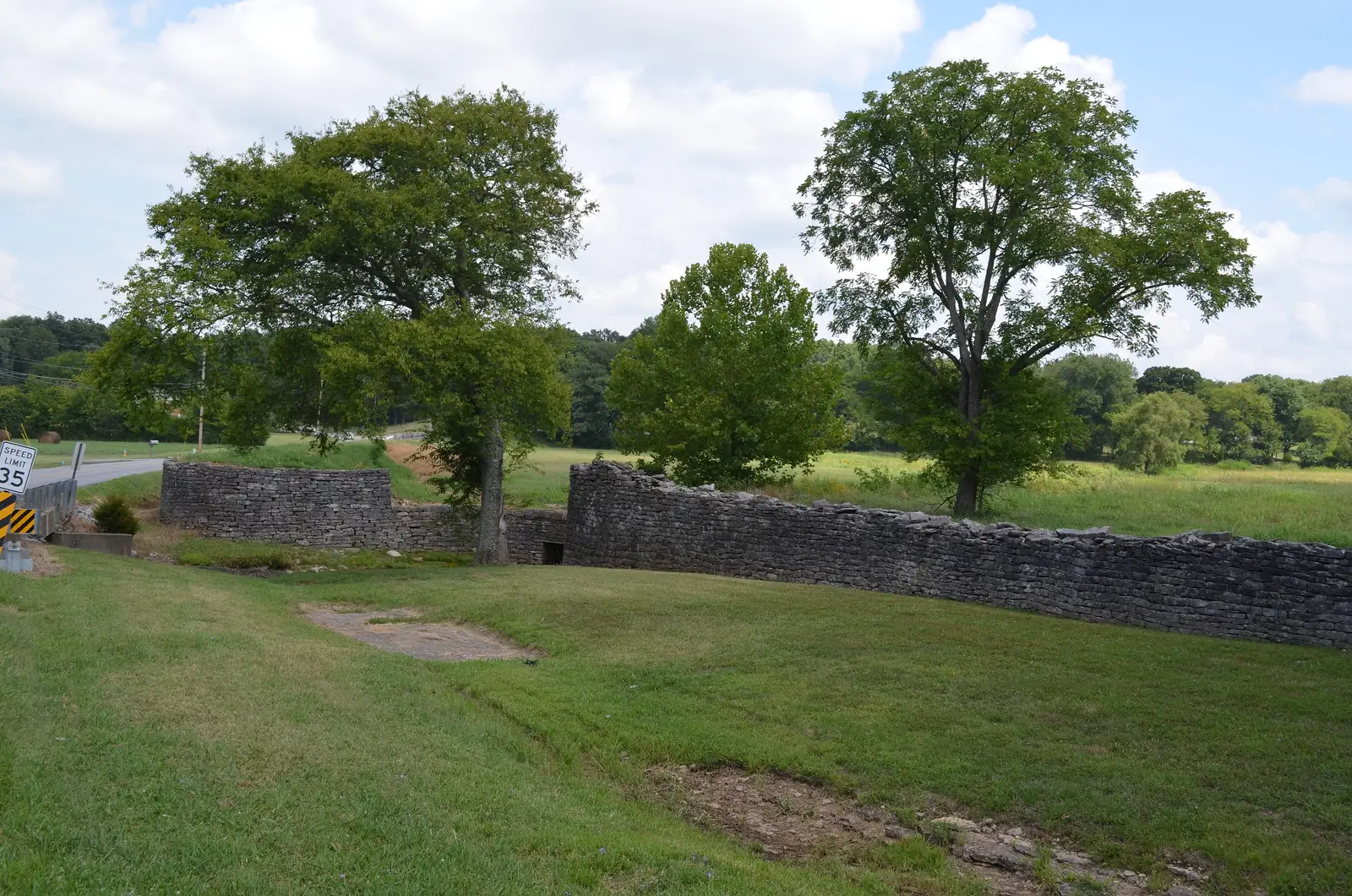
- The Chandler Stone Wall, 200 Old Lebanon Dirt Road, pictured above
The plan calls for more medium-density housing here. Road projects it lists: widening and safety work on Old Lebanon Dirt Road, the Central Pike interchange at I-40, widening the Mt. Juliet Road bridge over I-40 and widening West Division Street from North Mt. Juliet Road to South Greenhill Road.
Schools
We checked 20 points spread across Division Street West in the district’s zone lookup. They split into two groups:
| Part of the area | Elementary | Middle | High | Points |
|---|---|---|---|---|
| South and west, toward I-40 | Springdale (11), Stoner Creek (2) | West Wilson | Mt. Juliet High | 13 |
| North, near West Division Street | Mt. Juliet Elementary (6), Elzie D. Patton (1) | Mt. Juliet Middle | Green Hill High | 7 |
Grades are from the state’s 2024-25 A-F letter grades:
| School | Address | 2024-25 grade |
|---|---|---|
| Springdale Elementary | 5675 Central Pike | A |
| Stoner Creek Elementary | 1035 N. Mt. Juliet Road | A |
| Mt. Juliet Elementary | 2521 W. Division St. | B |
| Elzie D. Patton Elementary | 1003 Woodridge Place | B |
| West Wilson Middle | 935 N. Mt. Juliet Road | A |
| Mt. Juliet Middle | 3565 N. Mt. Juliet Road | A |
| Mt. Juliet High | 1875 Golden Bear Gateway | A |
| Green Hill High | 220 N. Greenhill Road | A |
Because the line runs through the area, check the exact address in the zone lookup. Full results are on the Tennessee State Report Card. More in our schools guide.
Home values
Zillow’s typical home value for ZIP code 37122 was $565,761 in September 2026, up 0.5% from $562,819 a year earlier; the city figure was $556,817. The index is a modeled value for a typical mid-priced home, not a sale price, and Zillow does not publish it below the ZIP code level. More in home prices.
Parks and trails
- Robinson Family Park, 1200 N. Mt. Juliet Road: a half-mile wraparound hiking trail, outdoor fitness equipment and a certified wildlife habitat, according to the city’s plan and parks pages.
- West Division Street Pedestrian Trail and Bikeway, along the north edge.
- Town Center Trail Phase 3, from South Greenhill Road to Mt. Juliet Elementary, under construction, according to the city.
More in parks and trails.
Getting around
- Main roads: North Mt. Juliet Road (State Route 171), West Division Street, Old Lebanon Dirt Road and Pleasant Grove Road, with Central Pike (State Route 265) just south of I-40.
- Nearest I-40 exit: Exit 226 (Mt. Juliet Road). The western edge is about as close to Exit 221 (Old Hickory Boulevard) in Hermitage. Exit numbers are from OpenStreetMap.
- Distances by road from Mt. Juliet Elementary, measured on OpenStreetMap’s road network: about 2.9 miles to City Hall and about 10.6 miles to Nashville International Airport. These are distances, not drive times.
- Transit: Mt. Juliet Station for the WeGo Star, 22 E. Division St., is northeast of the area.
More in getting around.
Groceries and everyday stores
OpenStreetMap lists the Walmart Supercenter, 300 Pleasant Grove Road, near North Mt. Juliet Road at the area’s east side. ALDI, 315 N. Mt. Juliet Road, is across the road.
Related: Greenhill, Town Center, Providence and property taxes.
Frequently asked questions
Where is Division Street West in Mount Juliet?
It is the city’s Planning Area 5: the land south of West Division Street and north of Interstate 40, from North Mt. Juliet Road west to the Davidson County line, about 5,044 acres in the city’s land use plan.
What high school is Division Street West zoned for?
It is split. In the Wilson County Schools zone lookup, 13 of the 20 points we checked returned Mt. Juliet High and seven, near West Division Street, returned Green Hill High. Both earned an A for 2024-25.
Is Division Street West a good place to live?
Here are the facts. Division Street West is a 5,044-acre planning area with Robinson Family Park and Mt. Juliet Elementary, split between Mt. Juliet High and Green Hill High, both rated A for 2024-25; the typical home value in ZIP 37122 was $565,761 in September 2026, according to Zillow.
Is there a new I-40 interchange planned at Central Pike?
Yes. A Central Pike interchange at I-40 is in the city’s plan for this area, and our getting around guide lists it as planned.
Have your say